


Land Surveying in Captiva, FL
Looking for licensed land surveyors in Captiva, Florida? Florida Builders, Engineers & Inspectors provides accurate, professional land surveying services for residential, commercial, and development projects throughout Lee County and the surrounding barrier islands.
Our experienced team uses advanced GPS, drone, and LiDAR technology to deliver precise, compliant surveys that help property owners, builders, and developers avoid costly delays, streamline permitting, and protect their investment.
📞 Call (877) 894-8001 today for a free quote.
Our Land Surveying Services in captiva
All surveys are delivered as clear, detailed digital PDF reports ready for permitting, construction, or property transactions.
About Captiva
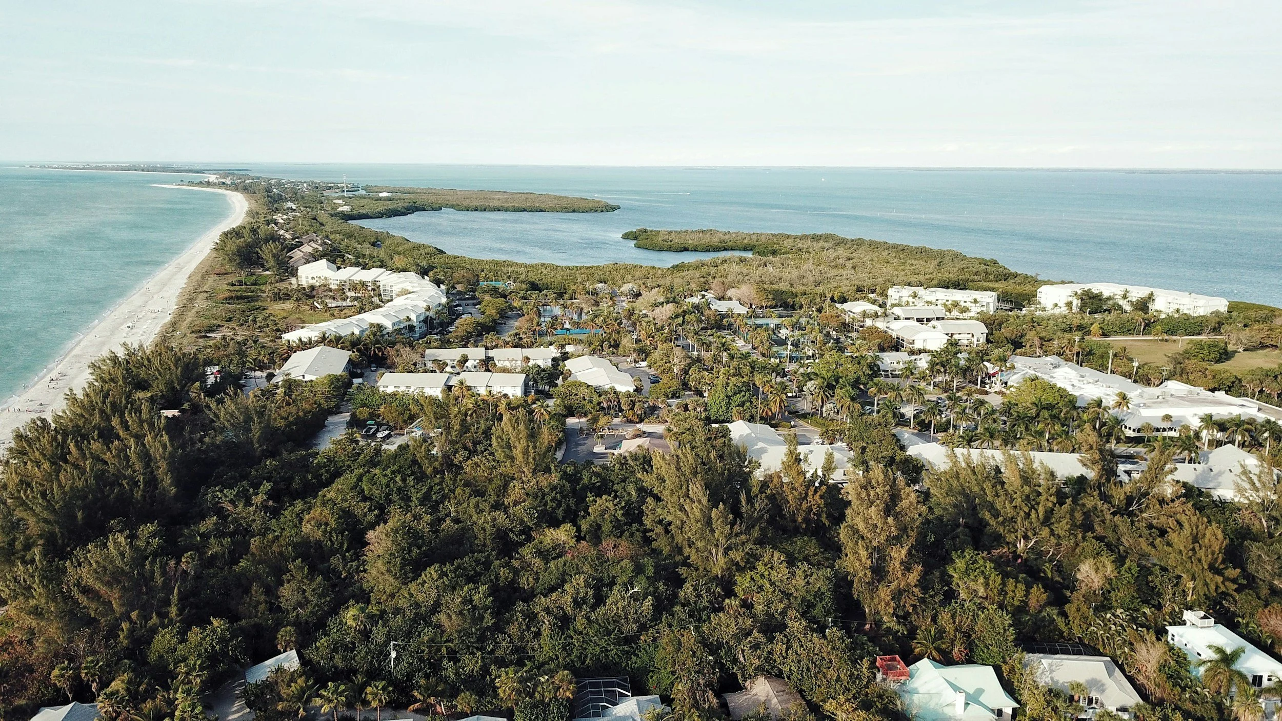
Captiva, Florida, is a scenic barrier island in Lee County, renowned for its pristine beaches, luxury waterfront homes, and protected natural preserves. Whether you’re planning a custom home, purchasing property, or preparing a residential or commercial development site, professional surveying is essential to ensure compliance with local zoning, building, and environmental regulations.
Our local surveyors are experienced with Captiva’s unique coastal land conditions, wetlands, and permitting requirements, helping property owners avoid boundary disputes, construction delays, and regulatory challenges while protecting their investment.
Why Choose Florida Building & Land Surveying
Serving communities across Florida, our licensed surveyors provide precise boundary, ALTA/NSPS, and FEMA flood elevation surveys. We ensure your home additions, commercial projects, or property transactions comply with local zoning, building, and floodplain regulations while protecting your investment.
Areas We Serve Near Captiva, Florida
Our Fort Myers / Lee County survey team provides licensed, professional land surveying services throughout Captiva and the surrounding communities, offering local expertise and reliable service for every project.
We proudly serve:
We deliver timely, accurate surveys across Southwest Florida for residential, commercial, and development projects.
When Do You Need a Land Survey in captiva?
You may need a survey when:
Buying or selling property
Building a home addition or new structure
Installing fences, pools, or driveways
Applying for permits
Refinancing or obtaining title insurance
Determining flood zone elevations
Professional surveying helps prevent disputes, delays, and costly mistakes.

Contact our Captiva, FL Surveyors
Ready to start your project in Babcock Ranch, FL?
📞 Call (877) 894-8001 to speak with a licensed survey expert or request a free quote online.
Florida Building & Land Surveying provides accurate, reliable land surveys to ensure your property, construction, or development project meets all local requirements and stays on track.
🔍 Captiva, FL Land Survey FAQs
1. What is a Boundary Survey in Captiva?
A Boundary Survey in Captiva identifies the precise property lines and corners of your residential or commercial property. This ensures compliance with Lee County regulations and helps prevent disputes before construction or property improvements.
2. Why would I need an ALTA/NSPS Survey in Captiva?
An ALTA/NSPS land survey in Captiva is important for commercial properties, waterfront lots, or high-value homes. It provides detailed property information including easements, encroachments, flood zones, and legal descriptions to protect your investment.
3. What is a FEMA Flood Elevation Certificate and why is it important in Captiva?
A FEMA Flood Elevation Certificate in Captiva measures the elevation of your building relative to flood zones. For flood-prone areas, it helps reduce insurance costs and ensures compliance with Lee County floodplain regulations.
4. How do I know if my Captiva property is in a flood zone?
Our licensed surveyors use FEMA maps and on-site measurements to determine if your property is in a designated flood zone. We provide accurate certificates and guidance to meet flood insurance requirements and Lee County regulations.
5. How long does a Boundary or ALTA Survey take in Captiva?
Survey timelines vary based on property size, type, and location. Most Captiva boundary surveys are completed in a few days, while ALTA/NSPS or Flood Elevation Certificates may require additional time for research and fieldwork.
6. What are “Table A” items for ALTA Surveys in Captiva?
Table A items are optional elements, such as utility locations, zoning details, monuments, or environmental features. They allow customization of your ALTA land survey in Captiva to meet specific property or development needs.
7. Do I need a survey when buying property in Captiva?
Whether purchasing a home, commercial property, or vacant land, a professional Captiva land survey ensures accurate boundaries, easements, and flood zone compliance, helping avoid costly surprises during closing.
8. How much does a Captiva land survey cost?
Survey costs depend on property size, survey type, and complexity. ALTA/NSPS surveys are more comprehensive and typically cost more than standard boundary surveys, but they provide thorough documentation for high-value Captiva properties.
9. Can surveys help with permits and construction in Captiva?
Our licensed Captiva surveyors provide all documentation required by Lee County for building permits, property additions, or commercial projects. Accurate surveys help your project meet local regulations and avoid delays.
10. How do I schedule a land survey in Captiva?
Call us at (877) 894-8001 to schedule a Boundary, ALTA/NSPS, or FEMA Flood Elevation Certificate survey. Our licensed Captiva surveyors deliver precise, timely, and compliant results for both residential and commercial properties.